NASA · 2017–2025
Flood Mapping System
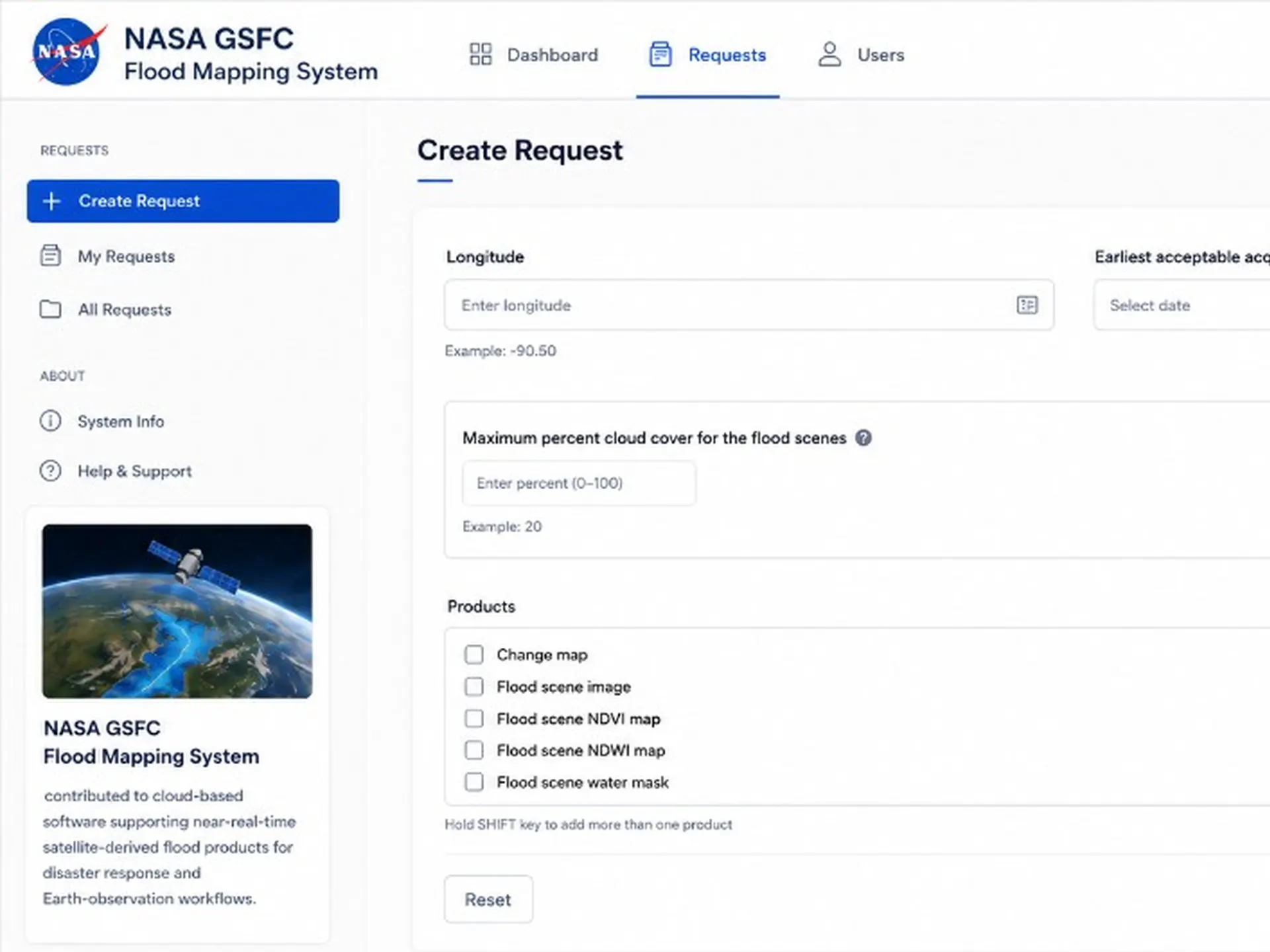
Near real-time flood inundation mapping from satellite data — built for disaster response when latency is measured in hours, not sprints.
My role Architect & lead developer — designed and automated the end-to-end geospatial pipeline on AWS.
Near RT
Product generation
Global
Disaster coverage
Delivered near real-time flood inundation maps during active disaster events worldwide.
Problem
- Manual processing steps delayed flood products during active global disaster events.
- End-to-end workflows from sensor acquisition to dissemination spanned multiple teams and environments.
- Operational users needed trustworthy, repeatable products — not one-off engineering heroics.
Approach
- Automated the pipeline from raw sensor ingestion through geospatial product generation.
- Containerized processing stages for repeatable deployments across environments.
- Integrated outputs with emergency management and research distribution networks.
Outcome
- Delivered near real-time flood inundation maps during active disaster events worldwide.
- Reduced manual handoffs that introduced latency and inconsistency under urgency.
- Supported peer-reviewed research on global water and flood mapping (GeoHorizons).